| H | Y | D | R | O | G | R | A | P | H | I | C | S | U | R | V | E | Y | S | |
|
|
|
|
|
|
|
|
|
|
|
|
|
|
|
|
|
|
|
|
 |
 |
 |
 |
 |
 |
 |
 |
 |
 |
 |

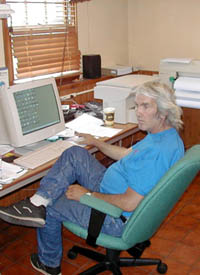
JAMES L. STEFFEN
PARTNER / OWNER
EDUCATION
On September 14th, 1988
James L. Steffen obtained certification as an In-Shore Hydrographer from the American Congress of Surveying and Mapping.
EMPLOYMENT
from 1968 to 1973
During the above period James L. Steffen worked for Professional Planners as chief of party on high precision control surveys.
from 1973 to 1980
During the above period James L. Steffen worked as chief of party for Dredging Companies (including American Dredging
Company, previously located in Camden, NJ) working on hundreds of projects doing various types of fathometric surveys
from 1980 to Present
During the above period James L. Steffen has been a partner/owner of Hydrographic Surveys. Hydrographic Surveys specializes
in fathometric surveys and has performed over 1,500 surveys. Mr. Steffen is in charge of AutoCAD, the computer department,
quality control of all field data, editing and processing of data, design and plotting, volume calculations, 3-D modeling, project
scheduling and control, proposals and estimates, survey reports, geodetic layout, horizontal and vertical control. Jim is a GPS
technician, computer technician and project designer.
AREAS OF EXPERTISE
James L. Steffen utilizes Hydrographic Survey software Hypack Max, operating system windows XP, for post processing of data.
All data is inspected thoroughly. Each survey run is viewed in Hypack Max software and compared to the fathometer analog, to be
sure they correspond. Face soundings are always examined carefully during the post processing procedure. Drawings are produced
in AutoCAD, release 14.
Jim Steffen has been in the hydrography field for nearly 30 years and a partner/owner of Hydrographic Surveys since 1980. Jim is in charge of AutoCAD, the computer department, quality control of field data, editing and processing of data, design and plotting, volume calculations, 3-D modeling, project scheduling and control, proposals and estimates, survey reports, project design, goedetic layout and horizontal and vertical control.
Copyright © 2005 Hydrographic Surveys.