| H | Y | D | R | O | G | R | A | P | H | I | C | S | U | R | V | E | Y | S | |
|
|
|
|
|
|
|
|
|
|
|
|
|
|
|
|
|
|
|
|
 |
 |
 |
 |
 |
 |
 |
 |
 |
 |
 |
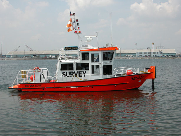
Our Survey Vessel "The Michele Jeanne"
Fathometric surveys are performed in order to determine the underwater topography of a specific project site. The echo depth
sounding we use is a method of measuring water depth by computing the time interval required for sound waves to travel, at a
known velocity, from a known point to a reflecting surface and return. If the time is measured between the transmission of a sound
and the reception of its echo, the distance may be computed by multiplying one half of this time interval by the velocity of sound
in water. Speed of sound varies in accordance with salinity content and temperature of water. Typical variations are from 4550
to 5050 feet per second, increasing with both temperature and salinity. Sound waves are generated and received by a dual frequency
transducer operating at 200kHZ and 24kHZ. Our Innerspace 456 Survey Sounder processes this information and provides depths
in analog and digital formats. The survey sounder employs a dynamic tracking range gate that allows only the bottom to be digitized,
effectively eliminating false returns from suspended debris or fish.
Constantly changing marine bottoms require frequent and up to date surveys of topographic data. Site data can then be used in various
aspects of project planning, design, construction and maintenance. Inaccurate or misinterpreted data can cause enormous and innumerable
problems in various stages of project development in terms of both operations and cost. Hydrographic Surveys uses myriad state-of-the-art
surveying equipment to ensure the highest precision in waters ranging from deep to shallow, including the Starlink 212/MBA-2DGPS
(Global Positioning System) Submeter Positioning System, Innerspace 448 Precision Survey Fathometer and TSS (DMS-10) Heave
Compensator. Our 24-foot aluminum Monark is customized for high maneuverability with many innovative surveying features, as well as
our newest boat, the Michele Jeanne.
Pre- & Post-Dredge Surveys
Determining the extent and composition of the material to be removed during dredging is the most critical element of a successful dredging
project. Providing accurate survey data and comprehensive analysis of bottom conditions is what we do at Hydrographic Surveys. Our
services go far beyond simply acquiring and processing surveys. We are able to accurately determine how much material needs to be removed,
if and where any shoals exist, as well as how much material has been removed to help in the planning and design process. Our nearly 60 years
combined experience using powerful industry standard software and hardware serves our clients well.
Condition Surveys / Dual Frequency
Planning a successful dredge project requires a thorough knowledge of bottom conditions. Knowing the type of materials to be removed is
especially important for planning of removal and disposal. Hydrographic Surveys is able to provide condition surveys that accurately measure
for soft layers of material on the bottom. Our Innerspace Technologies Model 456 Survey Depth Sounder in conjunction with a dual frequency
(200kHz/24kHz) transducer which provides very accurate separation of hard and soft layers of material. Our specialized bow-mounted transducer
bracket gives us the capability to retrieve precise echo-soundings right up to the face of structures.
Copyright © 2005 Hydrographic Surveys.